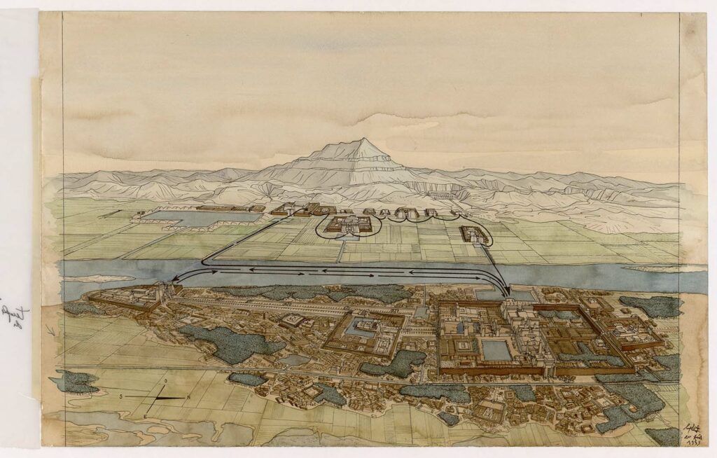
Aerial view of the liturgical circuits of Karnak and the West Bank. The drawing is in landscape format. It is organized within a frame drawn in ink. A sheet of tracing paper representing the schematized and captioned drawing is taped to the drawing sheet. Inscriptions appear on the reverse.
The drawing is arranged on either side of the Nile. The lower part of the drawing shows the city of Thebes, with the Temple of Luxor on the left, linked to the Temple of Mut by a sphinx dromos. On the right are the Temple of Amun-Ra and the Temple of Montu. In the upper section, between the Nile, the Theban summit and the Valley of the Kings, stand the Palace of Malgatta and its lake, the Temple of Ramses III, the Temple of Amenophis III, the Ramesseum and the Temple of Sety I. The drawing shows the route taken by the Opet Festival and the Valley Festival.


