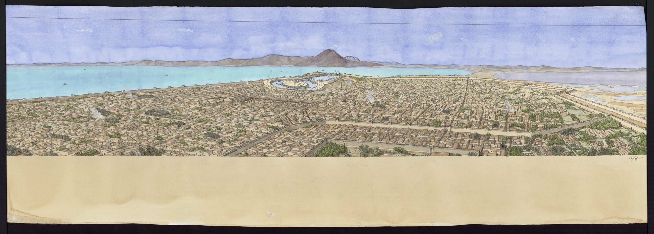
Panoramic aerial view of Carthago (Carthage) in Punic times. The drawing is in landscape format. It is framed in ink. Traces of watercolor are visible in the margins. Inscriptions appear on the reverse.
The city is located on the Mediterranean coast, visible in the upper part of the drawing. It is enclosed by several fortified walls, punctuated by towers and pierced by gates. In the foreground, the enclosure protecting the temple of Eshmoun is not visible. The large public square of the agora is below on the left of the drawing. Nearby, you can make out its two ports, one commercial, the other military. The first is rectangular in shape. Two towers line the entrance to the channel. The second port is circular. It is composed of loggias of ships arranged around the admiral’s command post, located on a central islet. The isthmus and lake are visible on the right. Mountains rise up in the distance.