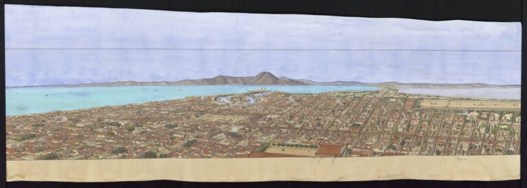
Aerial view of Carthago (Carthage), late 2nd c. Preparatory drawing on tracing paper. The drawing is in landscape format and has no frame. Inscriptions appear on the reverse.
The city is located on the Mediterranean coast. It stretches along the cardo (north-south axis) and decumanus (east-west axis) axes. The forum is located at the intersection. In the lower part of the drawing, you can see the two ports, one commercial, the other military. The first is rectangular. The second is circular. It is composed of ships’ loggias arranged around the admiral’s command post, located on a central islet. The entertainment monuments, the circus and the amphitheatre, are on the left of the drawing. The theater, odeon and thermal baths are in the upper part. The city’s water supply is provided by a huge aqueduct that extends across the upper part of the drawing.