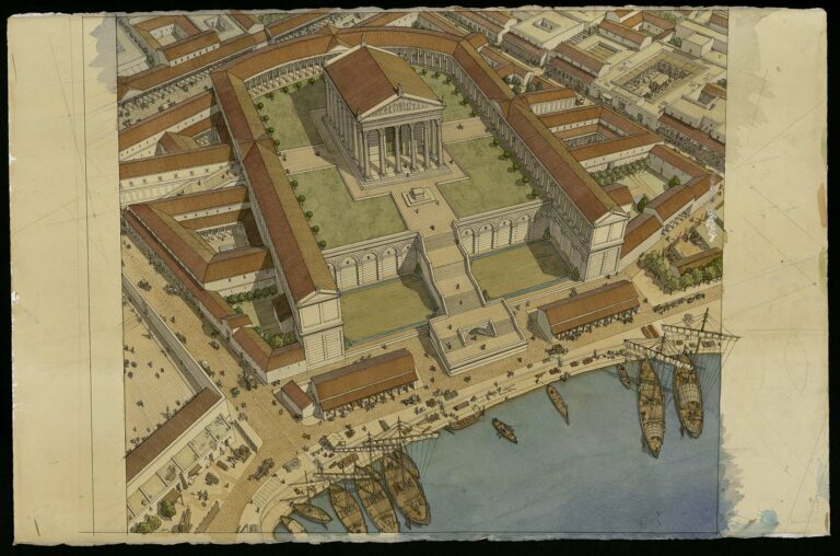

Aerial view of Caesarea Maritima (Caesarea) in the 2nd century. The drawing is in landscape format and has no frame. Inscriptions are visible on the reverse.
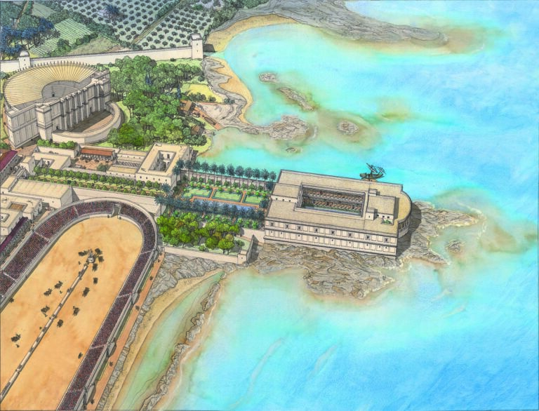
The town is located on the coast of the Mediterranean Sea, visible in the lower part of the drawing. It is open to the sea via a vast harbor, fortified by an enclosure punctuated with towers. The access channel is flanked by a lighthouse. Ships are moored. Goods are displayed on the quays. The town is organized around the port, on an orthonormal plan. A triumphal arch stands at the intersection of the cardo (north-south) and decumanus (east-west) axes. Both roads are lined with colonnaded galleries. Civic buildings are located nearby. The forum, with the temple of Augustus and Rome, faces the sea. The city features a stadium, visible from the seafront, a circus in the background, a theater on the right and an amphitheater on the left. A long aqueduct supplying the city with water can also be seen on the left.